
Millennia before the first wave lapped the shores of Martha's Vineyard, glaciers did their work. The last continental ice sheet ground down over Canada and across Cape Cod, pushing along rocks and boulders, sand and gravel, fossils and sediments from what author Norman Maclean calls the basement of time. The glaciers ebbed and flowed until their final retreat, and where the ice sheet surrendered 15,000 years ago, a new outpost of land heaved up into the world. Then, as the ice melted and the sea rose, that land dissolved into Staten Island, Long Island, Block Island, the Elizabeth Islands, Nantucket and Martha's Vineyard.
The first inhabitants of Martha's Vineyard were the Wampanoag, and they called the island Noepe, which means “in the midst of the sea.” And then, some say, the island was sighted by the Vikings in about 1000 A.D. before Italian explorer Giovanni di Verrazano in 1524 and a subsequent parade of Englishmen that included John Pease. Pease arrived in Edgartown, on the southeastern end of the Vineyard, in 1644. His family members have been on the island ever since.
In 2009, Ann Hoar Floyd '61 MT, a Pease family descendant and Edgartown resident, welcomed 11 Colby-Sawyer students and two professors to the hundred-square-mile island for the pilot of a field study course that has evolved into the biennial ENV 319 Marine Communities. A member of the college's President's Alumni Advisory Council and a proponent of experiential learning, Ann suggested creating the course to complement the River Communities and Desert Communities courses (Colby-Sawyer also added Alpine Communities in 2011). She offered the use of her Tom's Neck Farm, which has been in her family for more than eight generations and is now a rental property, as a base. The 57-acre farm borders Cape Pogue Bay on Chappaquiddick, a six-square-mile island that is part of Edgartown but separated from Martha's Vineyard by a narrow channel and accessed by a three-car ferry.
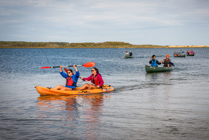
For the first six weeks of this academic year, Professor of Natural Sciences Ben Steele and Assistant Professor of Environmental Studies Harvey Pine taught a dozen students about the biology, ecology, geology and culture of Martha's Vineyard in the classroom. Most of the students hailed from New England (a couple even came from Cape Cod and the North Shore), and that familiarity made the material comfortable while creating plenty of motivation to dig deeper. By the time fall break rolled around, it was “high time to get to sea,” and the group set forth for three full days in a living classroom to more fully understand how humans both affect and have been affected by marine communities.
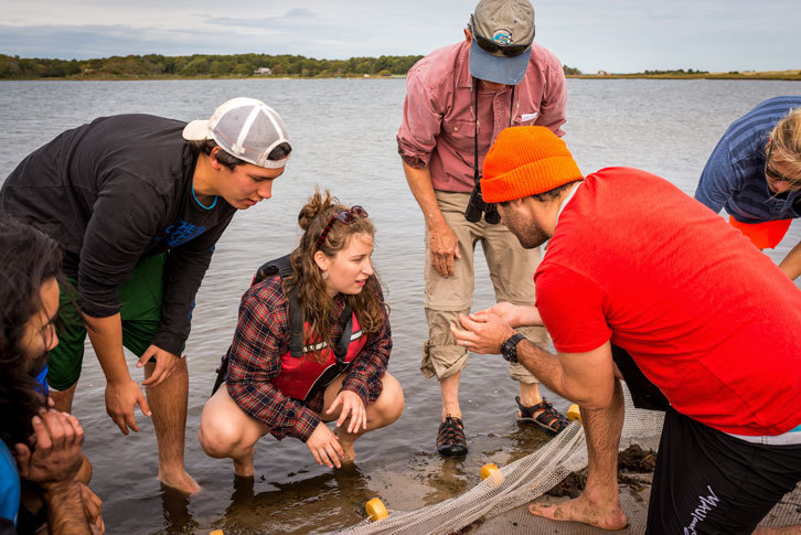
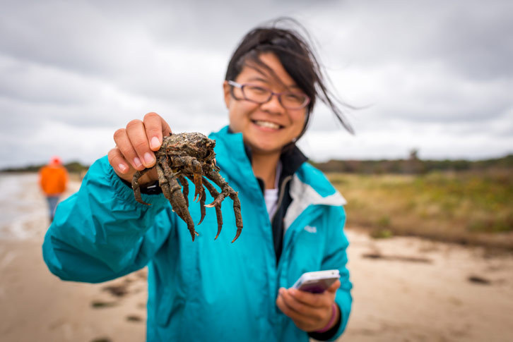
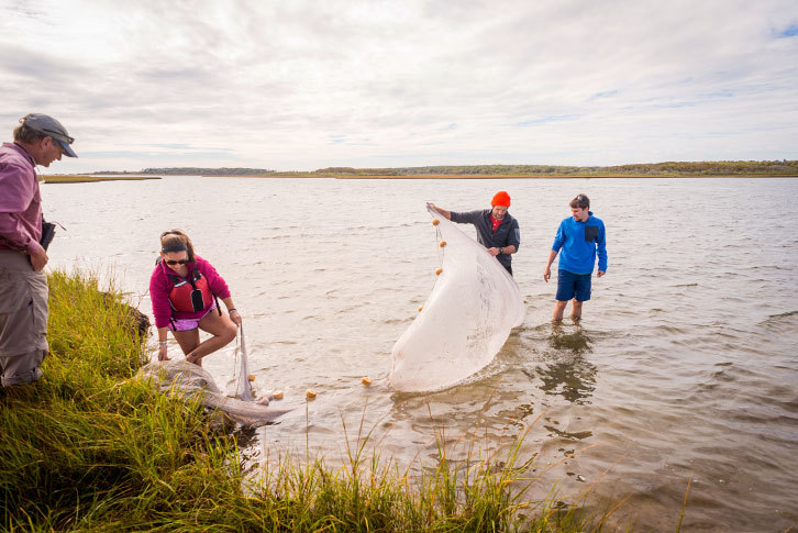
“We try to find places where students can see things actually happening and have hands-on experiences,” said Professor Steele. “We go to a shellfish hatchery, where they create seed to help stock scallop populations in the ponds, and grow oysters and mussels for seeding. We see the Wampanoag tribe and visit the Aquinnah Cultural Center to learn more about their history. We visit Oak Bluffs and the Woods Hole Oceanographic Institution, too.”
Harpoons and History
After a ferry ride in the dark from Woods Hole and a comfortable night at the farm, the class spent a cool and rainy first morning at the Gale Huntington Research Library in Edgartown with Ann and local experts. Students had the opportunity to examine primary sources—captains' log books, journals, letters, charts and maps—for their semester-long projects on tourism, agriculture, mammals, wind power, climate change, migratory birds, geology, Native American and whaling.
Martha's Vineyard is built on sand, memory and oil—whale oil. Though Herman Melville had neighboring Nantucket in mind when he wrote that “all these brave houses and flower gardens came from the Atlantic, Pacific and Indian Oceans … one and all they were harpooned and dragged hither from the bottom of the sea,” he may as well have been describing Martha's Vineyard, and Edgartown, especially, with its impressive Greek Revival captains' houses and handsome churches. The past is never far away on the island, and it doesn't take long to discover that everything is connected. A Pease was aboard the Lydia, the first recorded whaleship that sailed from Martha's Vineyard in 1765, and it was Captain Valentine Pease who commanded a young Melville on the Acushnet in 1841. Those forays into Melville's “wild and distant seas” where whales rolled their “island bulk” and gave up their spermaceti for lamp oil and candles made Edgartown a 19th-century port of power and wealth. Besides illuminating America, though, the whaling voyages linked the tiny island to the rest of the world.
Writer and photographer Mark Alan Lovewell offered a guest lecture one night under the guise of a singer of sea chanties and teller of stories. Ann claims him as a relative, and they both claim the Pease name. Lovewell stood in the white wood-paneled living room of the 1740s Tom's Neck farmhouse with an antique spinning wheel to his left and a flat-screen television to his right, a guitar in his hands and a harmonica poised in its holder with a concertina on standby. He regaled his audience with tales of the island and assured them that it's so much more than its popular image as a sleepy summer resort for the rich and famous, more than the site of presidential vacations and tragedies.
“What's so amazing about the history of Martha's Vineyard is that one might think it is really quite isolated,” he said, “but because of the whaling industry, we have so many connections to the rest of the world. We're actually far more international from our standing as a whaling community than as a tourist community because the tourists come here. We were out there.”
Ann glowed like a lighthouse as he invoked their island's past, and then he launched into another vigorous sea chanty. “What will you do with a drunken sailor?” he demanded to know, and the room reverberated with the multiverse answer.
Whaling, for the most part, came to an end in the 1860s with the Civil War and the discovery of coal in Pennsylvania. Edgartown's wealth fell away, and the town became “desperately destitute,” according to Lovewell. The islanders' hunt for whale oil turned to a hunt for whale bone in the waters off Alaska to stiffen corsets, until those contraptions fell out of favor. Farewell and adieu.
“We were whalers, we were whalers, we were Chappaquiddick whalers,” Lovewell whispered, and it sounded like a prayer.
Shifting Sands
In contrast with the island's rugged seafaring past is Martha's Vineyard's fragile ecosystem that is shrinking and sinking as warming, rising seas gnaw on the island's beaches and cliffs. According to the Arctic Monitoring and Assessment Program, the sea level is expected to rise at least five feet by the end of this century.
From one end of the island to another, the impact of the changes already underway became abundantly clear to the students as they got to know the crumbling cliffs and ever-changing landscape. At Lucy Vincent Beach in Chilmark, where rolling hills fill the Vineyard's southwest shore and the sunsets are unparalleled, Professor Pine explained that the shoreline has already receded about 400 feet in the past hundred years and that the cliffs are half the height they once were. Sharp eyes spotted several fossilized shark teeth that the churned-up beach revealed.
On the far west coast in Aquinnah, where the Wampanoag tribe has its trust land, the iconic Gay Head Light atop its colorful cliffs will be moved 150 feet this spring to avoid certain doom. At Wasque Beach on Chappaquiddick's southeast tip, the group saw an 8,300-square-foot summer home that took a multimillion-dollar trip of 275 feet to save it from tumbling into the sea after the property lost 150 feet of land in just one year.
The scale of the erosion was one of the trip's biggest surprises for many students, including environmental studies major Jacob Conroy '17. “This is an eye-opening experience,” he said. “Our marine ecosystems are important to the rest of the world, and we need to pay attention to how the coastlines are moving; people really disrupt the habitat by building close to the water. It's different to be in the field and learn this stuff up close instead of just seeing a picture.” Junior Joshua Altshuler's topic of study for the course was climate change and how it will affect the Vineyard. By the end of his time on the island, he could tick off the current and future dangers: “We know that rising sea temperatures increase the spread of certain diseases for marine species such as oysters and clams. Sea-level rise is also going to impact the coastal ecosystems and communities of Martha's Vineyard. There's a huge problem with increased storm frequency and intensity; they're really going to hammer the island,” he said. “I'm trying to find out which areas will be impacted by these climate changes the most and how communities can adapt and protect not just their lifestyles but also the ecosystems that make up the island, because what makes this place unique is that the residents put a lot of effort into conserving land. Almost 40 percent of the island is preserved as open space.”
If You Love Something, Let it Go
There's geological time and there's human time, and while the long, long-term picture for the Vineyard may be soggy, plenty of islanders are doing everything they can to preserve the land and vistas that are still there. Ann is one of them. On a sunny, breezy morning, Ann walked with the students around Tom's Neck Farm, which includes a beautiful beach plus fields, hills and woodlands that surround Pease Pond. She led the way down sandy paths to the water's edge and showed the students where the Wampanoag's winter camp once was.
Originally 160 acres, Tom's Neck became one of the first successful farms on Chappaquiddick. It entered Ann's family more than a century ago, when it was especially known for its sheep and asparagus crop.
For more than two decades, Ann has worked to find a way to preserve as much of the land as possible. This summer, she sealed the deal on a solution, but to keep the land open forever, she had to let some of it go. The Martha's Vineyard Land Bank will purchase 25 acres of the historic coastland along the bay and surrounding Pease Pond, so that it will be permanently accessible to the public and avoid development.
It was a long struggle and a process to preserve the land, Ann said, and there were compromises along the way, but her effort is already making an impression.
“It was so refreshing to hear Ann talk about how she worked so hard to conserve the land,” said Emmy Rioux '16, a biology major from Maine. “That was a great part of the trip.”
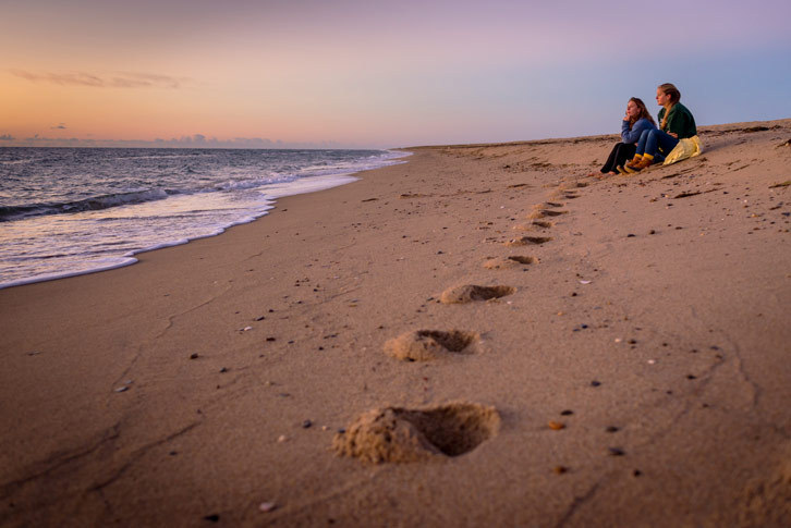
Everything's connected, including the members of the field studies class who spent days together on an island living and learning from each other and the surroundings. There was minimal Internet access at the farm, and no demands from the rest of the world to do anything but reaffirm that there is magic in water.
“Stay in touch,” Ann told the students as she hugged them goodbye. “Come back and visit.” And when they do, because of people like her, there will be space and time on Martha's Vineyard for ocean reveries.